
Amravati to Bangalore Distance
The road distance between Amravati and Bangalore is approximately 1100+ km, and the drive usually takes around 19 hours by car or taxi, depending on traffic and road conditions. If you're travelling by air, Bengaluru International Airport is the nearest airport to Bangalore, located about 28 km away from the city centre. Flying is the fastest way to reach Bangalore, with a total travel time of approximately 6 hours. If you're planning a road trip, check weather and traffic updates before your journey, as monsoon showers or winter snowfall in hilly regions can increase travel time.
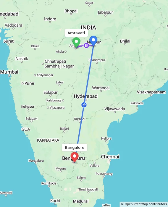
Via Nagpur
RECOMMENDED
FASTEST
Amravati
Nagpur
Bangalore
Approx Travel Time
5h 53m
₹6,671
Onwards
Amravati
Nagpur
Bangalore
Approx Travel Time
6h 20m
₹7,126
Onwards
Amravati
Nagpur
Bangalore
Approx Travel Time
6h 31m
₹9,383
Onwards
Via Nanded
Amravati
Nanded
Bangalore
Approx Travel Time
8h 18m
₹5,026
Onwards
Via Hyderabad
Amravati
Hyderabad
Bangalore
Approx Travel Time
20h 10m
₹1,545
Onwards
Via Adilabad
Amravati
Adilabad
Bangalore
Approx Travel Time
22h 39m
₹3,500
Onwards
Via Nanded, Hyderabad
Amravati
Nanded
Hyderabad
Bangalore
Approx Travel Time
22h 19m
₹7,145
Onwards
Amravati
Nanded
Hyderabad
Bangalore
Approx Travel Time
17h 43m
₹6,258
Onwards
Direct Options
Amravati
Bangalore
Approx Travel Time
18h 49m
₹33,853
Onwards
Via Akola, Hyderabad
CHEAPEST
Amravati
Akola
Hyderabad
Bangalore
Approx Travel Time
18h 59m
₹585
Onwards
Frequently Asked Questions
What is the distance between Amravati and Bangalore?
The distance between Amravati and Bangalore is approximately 1100+ km by road.
What is the straight-line (aerial) distance between Amravati and Bangalore?
The straight-line distance is approximately 850+ km.
How long does it take to travel from Amravati to Bangalore by road?
It takes around 19 hours by road.
What is the distance from Amravati to Bangalore via Nagpur?
Via Nagpur, the distance is approximately 1050+ km, taking around 6 hours.
Does the distance from Amravati to Bangalore change by route?
Yes — the road distance varies from 1100+ km via the direct route to 1050+ km via Nagpur, depending on the path taken.
Does travel time between Amravati and Bangalore vary by season?
Yes, travel time can increase during monsoon or winter due to road conditions in hilly or mountainous stretches.
What is the driving distance vs. straight-line distance between Amravati and Bangalore?
The driving distance is 1100+ km, while the straight-line distance is shorter at 850+ km, due to the road route following terrain and highways.
Routes Connecting Amravati
Routes From Amravati
Routes To Amravati
Routes Connecting Bangalore
Routes From Bangalore
Popular Places Routes
- Shimla to Changanassery
- Basti to Varanasi
- Cuttack to Nayagarh
- Nandgaon to Zaheerabad
- Laxmangarh to Dera-Bassi
- Titilagarh to Haldia
- Badrinath to Alwar
- Cuttack to Hyderabad
- Saharanpur to Keshod
- Rishikesh to Shahganj
- Fazilka to Jorhat
- Singrauli to Baran
- Itarsi to Sangrur
- Ahmedabad to Ghumarwin
- Gandhinagar to Kattappana
Top Routes
Popular Routes


© 2026 MakeMyTrip (India) Limited
Country India